Fitxategi:EU-Cyprus.svg

SVG fitxategi honen PNG aurreikuspenaren tamaina: 713 × 600 pixel. Bestelako bereizmenak: 285 × 240 pixel | 571 × 480 pixel | 913 × 768 pixel | 1.218 × 1.024 pixel | 2.435 × 2.048 pixel | 2.045 × 1.720 pixel.
Jatorrizko fitxategia (SVG fitxategia, nominaldi 2.045 × 1.720 pixel, fitxategiaren tamaina: 7,31 MB)
Fitxategiaren historia
Data/orduan klik egin fitxategiak orduan zuen itxura ikusteko.
| Data/Ordua | Iruditxoa | Neurriak | Erabiltzailea | Iruzkina | |
|---|---|---|---|---|---|
| oraingoa | 15:16, 1 otsaila 2020 | 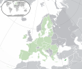 | 2.045 × 1.720 (7,31 MB) | Thom.lanaud | Re-up |
| 15:13, 1 otsaila 2020 |  | 2.045 × 1.720 (7,31 MB) | Thom.lanaud | Minus the UK and Gibraltar + the Channel Islands, which were never part of the EU | |
| 16:37, 25 urria 2016 |  | 2.045 × 1.720 (7,33 MB) | Giorgi Balakhadze | Rv of sockpuppet and per COM:OVERWRITE | |
| 04:10, 24 otsaila 2015 |  | 2.045 × 1.720 (7,38 MB) | Leftcry | Reverted to version as of 19:36, 16 November 2014 Really messed up the visual | |
| 14:05, 21 otsaila 2015 |  | 2.045 × 1.720 (2,89 MB) | VS6507 | Spain. Greece. Slovakia. Cyprus. Romania VETO | |
| 19:36, 16 azaroa 2014 |  | 2.045 × 1.720 (7,38 MB) | Leftcry | Reverted to version as of 11:31, 9 September 2014 Please go to your talk page | |
| 16:22, 16 azaroa 2014 |  | 2.045 × 1.720 (2,89 MB) | A2D2 | The map must show the original de-jure status with no breakaway regions, as it was originally created. An alternative map showing the de-facto status with breakaway regions needs to be created instead. | |
| 11:31, 9 iraila 2014 |  | 2.045 × 1.720 (7,38 MB) | Rob984 | Cyprus is not within Europe. Insert unnecessary. Other General improvements. | |
| 08:46, 1 uztaila 2013 |  | 2.045 × 1.720 (2,89 MB) | U5K0 | croatia | |
| 20:25, 28 maiatza 2012 |  | 2.045 × 1.720 (2,88 MB) | Chipmunkdavis | Increasing the detail of the inset using the image from File:Akrotiri and Dhekelia in United Kingdom.svg, greying out Akrotiri and Dhekelia, and increasing the lightness of the breakaway north while adding small black lines illustrating UN buffer zone ... |
Fitxategiaren erabilera
Fitxategi hau darabil ondorengo orri honek:
Fitxategiaren erabilera orokorra
Hurrengo beste wikiek fitxategi hau darabilte:
- af.wikipedia.org proiektuan duen erabilera
- ami.wikipedia.org proiektuan duen erabilera
- an.wikipedia.org proiektuan duen erabilera
- arc.wikipedia.org proiektuan duen erabilera
- ar.wikipedia.org proiektuan duen erabilera
- ar.wiktionary.org proiektuan duen erabilera
- as.wikipedia.org proiektuan duen erabilera
- azb.wikipedia.org proiektuan duen erabilera
- az.wikipedia.org proiektuan duen erabilera
- bcl.wikipedia.org proiektuan duen erabilera
- be-tarask.wikipedia.org proiektuan duen erabilera
- bh.wikipedia.org proiektuan duen erabilera
- bi.wikipedia.org proiektuan duen erabilera
- bn.wikipedia.org proiektuan duen erabilera
- bo.wikipedia.org proiektuan duen erabilera
- br.wikipedia.org proiektuan duen erabilera
- ca.wikipedia.org proiektuan duen erabilera
- cbk-zam.wikipedia.org proiektuan duen erabilera
- cdo.wikipedia.org proiektuan duen erabilera
- chr.wikipedia.org proiektuan duen erabilera
- ckb.wikipedia.org proiektuan duen erabilera
- co.wikipedia.org proiektuan duen erabilera
- cs.wikipedia.org proiektuan duen erabilera
- da.wikipedia.org proiektuan duen erabilera
- de.wikipedia.org proiektuan duen erabilera
- el.wikipedia.org proiektuan duen erabilera
- en.wikipedia.org proiektuan duen erabilera
- List of companies of Cyprus
- LGBT rights in Cyprus
- History of the Jews in Cyprus
- List of sovereign states and dependent territories in Europe
- United Nations Security Council Resolution 244
- Euro gold and silver commemorative coins
- Euro gold and silver commemorative coins (Cyprus)
- United Nations Security Council Resolution 889
- Talk:Georgia (country)/Archive 7
Ikus fitxategi honen erabilpen global gehiago.


